
the road to Philadelphia extended to Winchester and, from there, to Cumberland on the Potomac River
Source: David Rumsey Historical Map Collection, An accurate map of North America (Emanuel Bowen, 1767)
the road to Philadelphia extended to Winchester and, from there, to Cumberland on the Potomac River
Source: David Rumsey Historical Map Collection, An accurate map of North America (Emanuel Bowen, 1767)
The Scotch-Irish and Pennsylvania Dutch migrated from Philadelphia into the Shenandoah Valley, converting game trails and Indian paths into wagon roads good enough to carry their agricultural products back to Philadelphia.
The immigrants themselves constructed their roads. The colony of Virginia did not build roads for settlers to move south, which was topographically "up" the valley - there was no Virginia Department of Transportation then.
Once counties were established, county courts assigned responsibility for opening and maintaining roads to nearby landowners. The tithables of those landowners, often indentured servants prior to the American Revolution and enslaved workers, were required to work several days a year to keep roads in good repair. The House of Burgesses recognized that settlement in the Shenandoah Valley would require county governments to handle such local operations. The legislature started to authorize the creation of counties west of the Blue Ridge in 1738, starting with Frederick and Augusta counties.
The settlement pattern from north to south is reflected in the dates those county courts first organized and started making official decisions. Frederick County began operating in 1743. Augusta County was officially organized two years later. Hampshire County (now in West Virginia) was created in 1754.
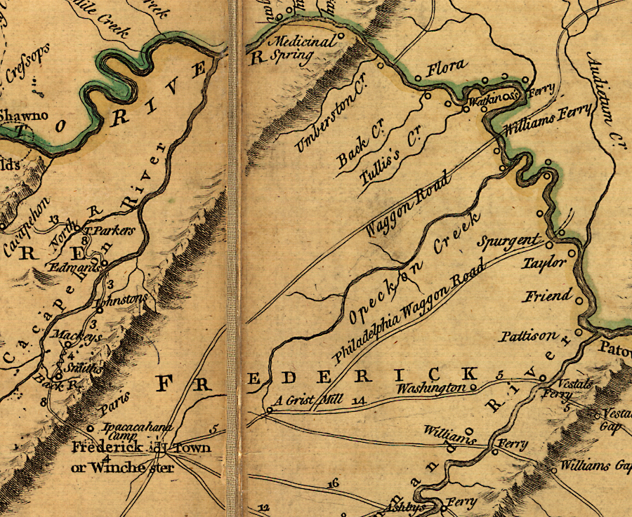
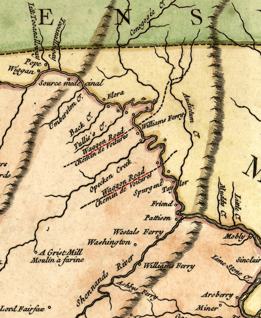
by 1755, two major crossings of the Potomac River converged at Winchester
Source: Library of Congress, A map of the most inhabited part of Virginia (by Joshua Fry and Peter Jefferson, 1755); Carte de la Virginie et du Maryland (by Joshua Fry and Peter Jefferson, 1757)
Today, I-81 and the earlier Route 11 parallel the Blue Ridge and transect Virginia, northeast to southwest. However, the original settlers did not construct their roads south of the New River and go straight to Tennessee. Carving the Wilderness Road through Southwest Virginia and finally across Cumberland Gap came after construction of a path through the Piedmont of Virginia into North Carolina (now US 220).
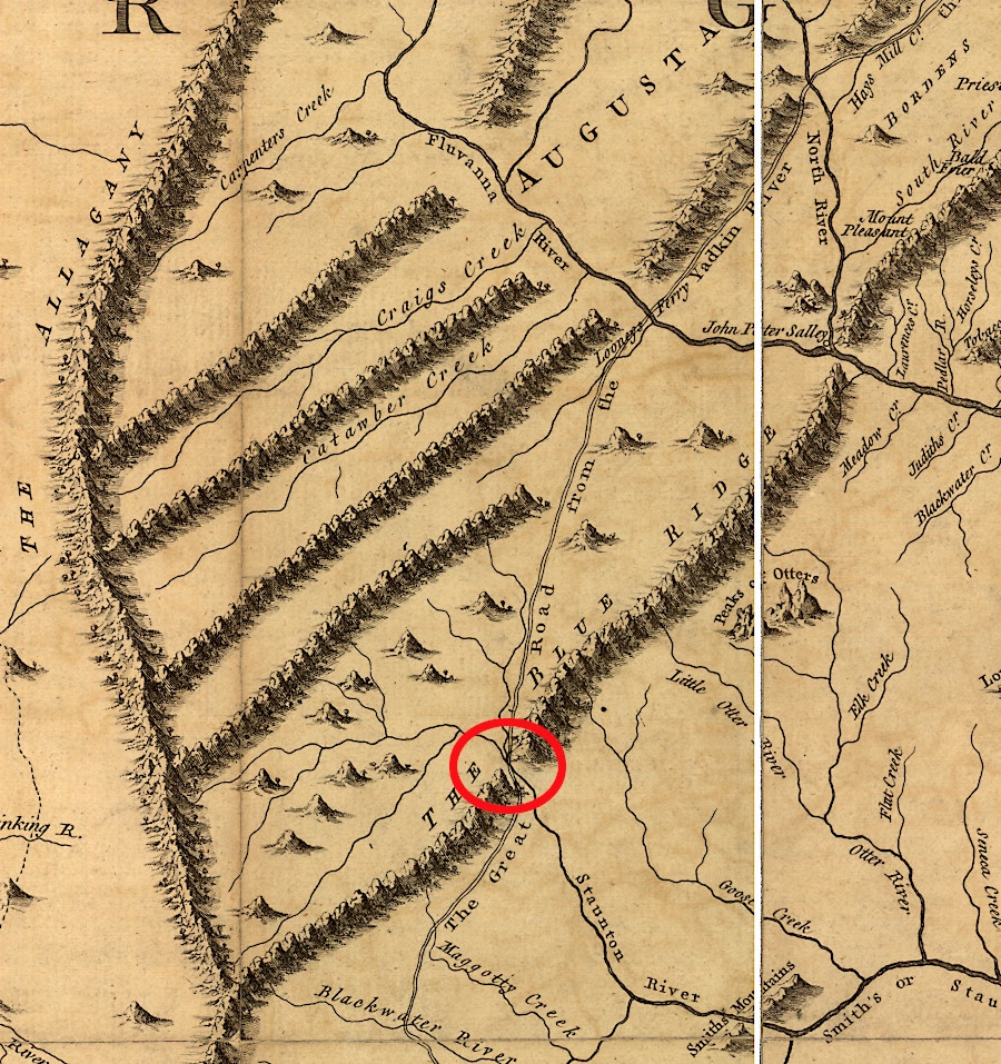
the road from Winchester forked at the Roanoke (Staunton) River, with one branch going south to the Carolina Piedmont
Source: Library of Congress, A map of the most inhabited part of Virginia (by Joshua Fry and Peter Jefferson, 1755)