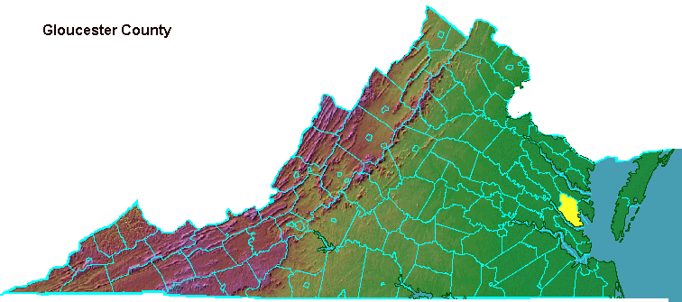
Gloucester County
One of the earliest visitors to Gloucester discovered in 1686 that prices charged to tourists can be different than the prices charged to local residents:1
- The place where we landed in the county Gloster is one of the most beautiful in all Virginia, but it is not the most healthful or inhabited by the most honest people. There are indeed no persons of quality.
- These honest people forced me to drink their cider willy-nilly, but had I wished to buy some, they would have charged me six sols a jug, while charging each other but two; therefore, although it made me ill, I drank only water. I could have stood it had it been good, for I had nothing else to drink during the last two & a half months.
Durand de Dauphine was a French Huguenot refugee who had planned to land in Charleston, in the southern part of the Carolina colony. Through various misfortunes, he was in Gloucester in 1686, where no one spoke French... and few people impressed him with their character:2
- I could not talk with anyone because I did not kow the language, & even if I had understood them, I would hardly have been better off for in this section there were only peasants, who were the worst scoundrels in Virginia.
The French visitor did have a critical eye for the local geography, as well as for the nature of the local inhabitants:3
- I discovered that nature had delighted in giving this land many useful charms, one of them being that at various points the sea extends into the land small inlets of a hundred & fifty to two hundered feet wide. The Indiands have settled along thee inlets, which they call Criks. On some there is only one plantation on each shore of the creek; but larger ones, which go farther inland, have as many as five or six.
- What they call the North river is an inlet of the Bees Sea, which extends five leagues ito the county of Gloucester & is three leagues wide. It is used in the same way by the inhabitants, as are also the four rivers [James, York, Rappahannock, and Patomac], all along their course. Naturally the creeks made by the rives are farther apart, but they are much longer & I have seen some extending two leagues into the land.
- As their houses are at most a hundred or fifty feet distant from these creeks, at ebb-tide they not only visit in their small boats, but carry their traffic through this channel, so that their horses & oxen do not work, except when they take a fancy to work them, or when the wind is high and they go by land and ride. These are so many little havens for the launches that come to load the casks of tobacco.
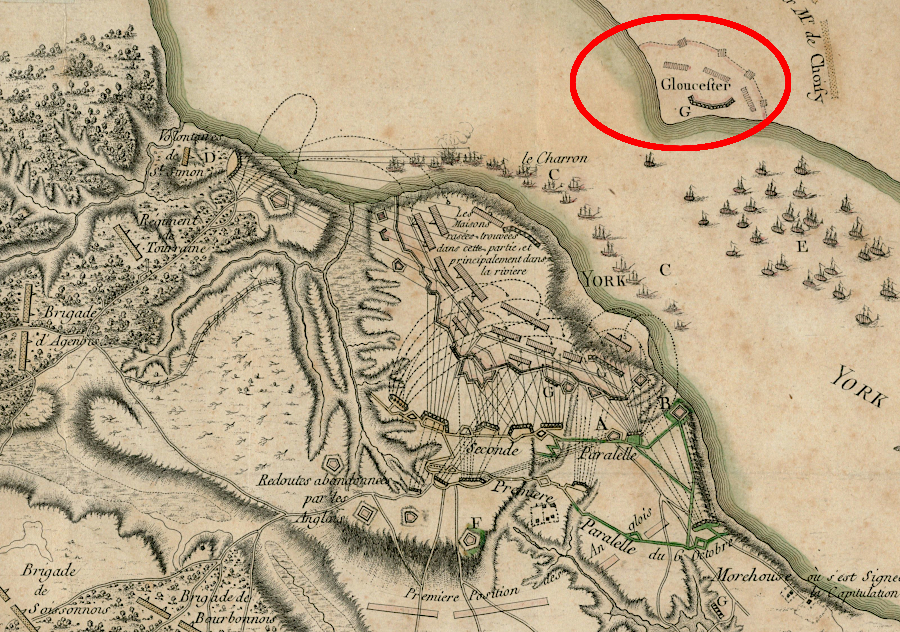
Cornwallis planned to escape the trap at Yorktown by crossing the York River and moving north from Gloucester County
Source: Leventhal Map Center, Boston Public Library, Plan de l'armée de Cornwallis attaquée et faitte prisoniere dans York Town
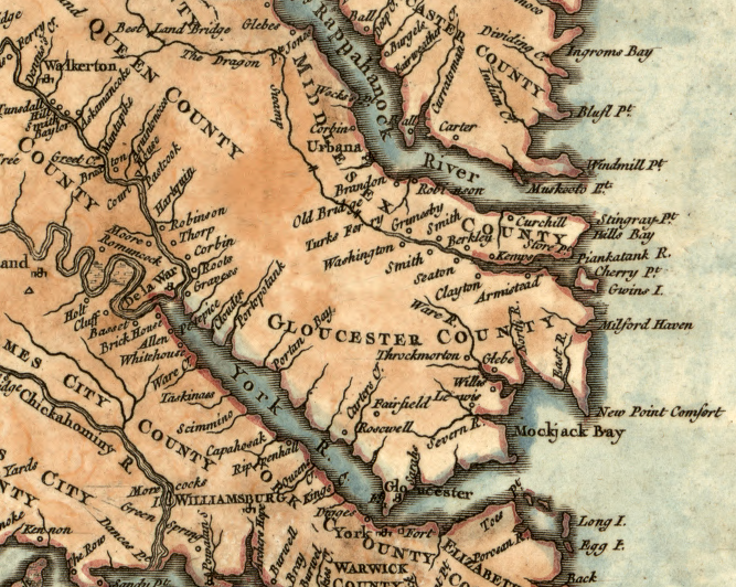
Gloucester County in 1757
Source: Library of Congress, Carte de la Virginie et du Maryland (1757)
Gloucester County at the start of the Civil War
Source: National Archives, Sheet No. 1 Military Reconnaissance
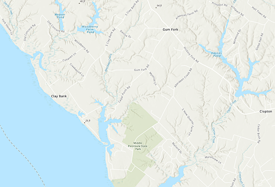
Gloucester County has little topographic relief, but mill ponds provided waterpower
Source: ESRI, ArcGIS Online
Links
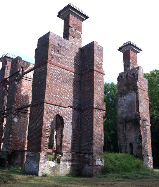
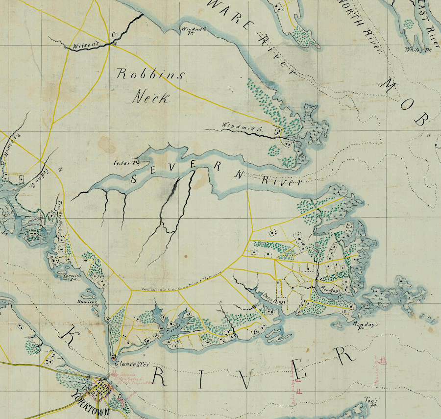
ruins of Rosewell, home of Mann Page II and Alice Grymes Page
on Carter Creek (Gloucester County)
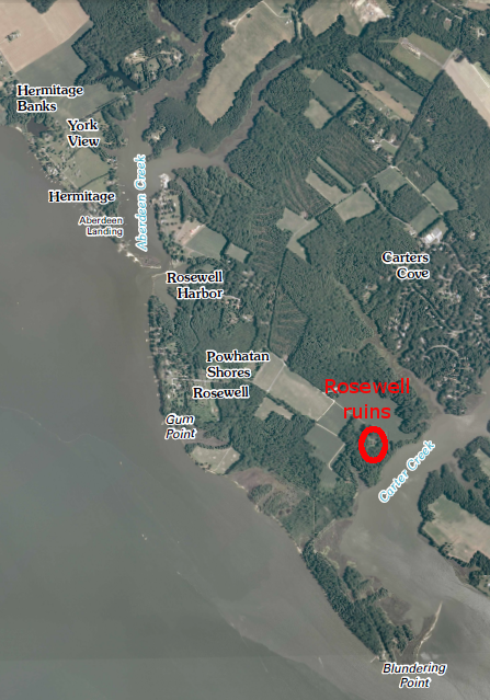
Rosewell at Carter Creek, near confluence with York River
Source: US Geological Survey (USGS), Clay Bank 7.5x7.5 topographic quad (2010)
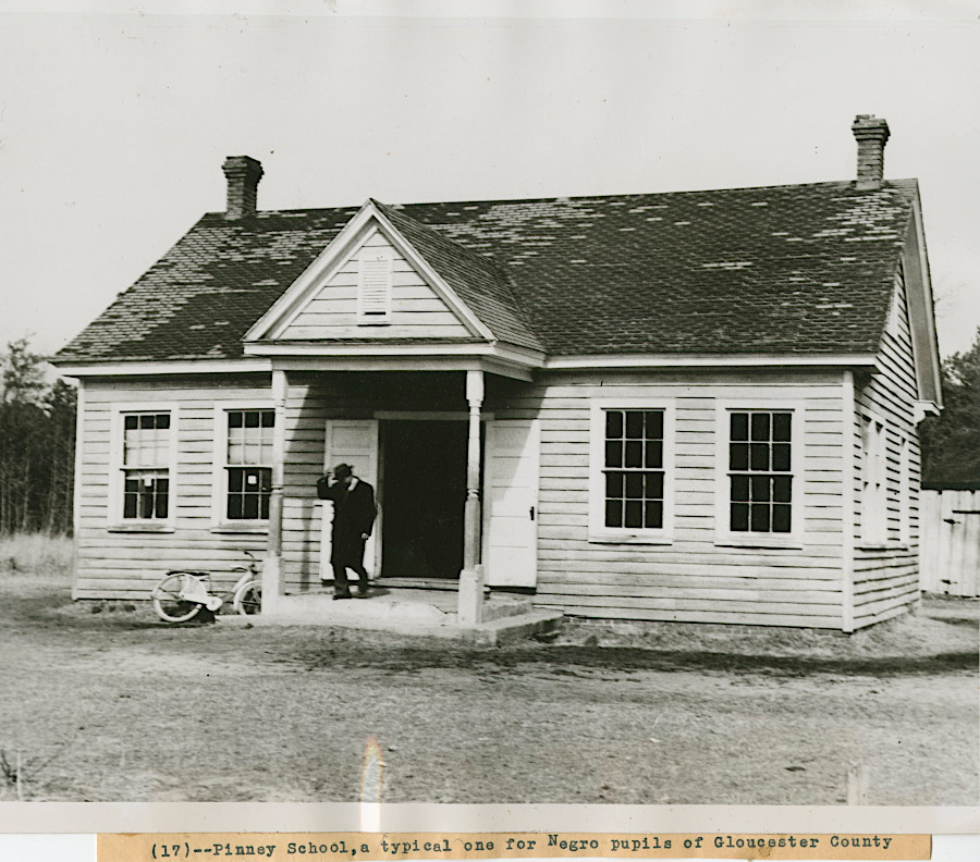
Pinney School in Gloucester County in 1948, when schools were segregated and unequal
Source: National Archives, Exterior View of the Pinney School
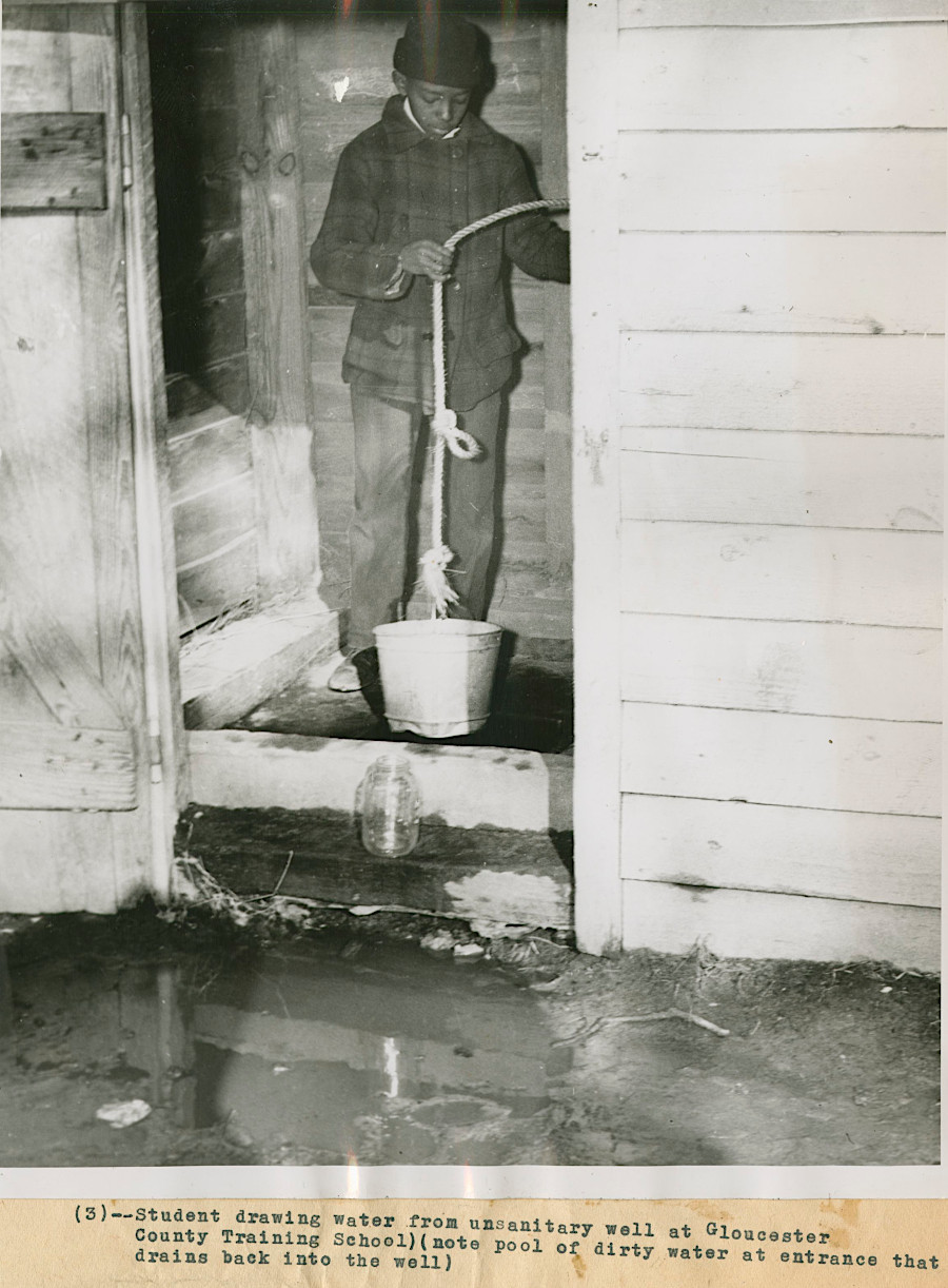
in 1948, students at Gloucester County Training School obtained drinking water from an unsanitary well
Source: National Archives, Photograph of a Gloucester County Training School Student Drawing Water from a Well
References
1. Durand de Dauphine, A Huguenot Exile in Virginia, or Voyages of a Frenchman exiled for his Religion with a description of Virginia and Maryland, (Gilbert Chinard, editor), The Press of the Pioneers, New York, 1934, p. 128, p.130
2. Durand de Dauphine, A Huguenot Exile in Virginia, or Voyages of a Frenchman exiled for his Religion with a description of Virginia and Maryland, (Gilbert Chinard, editor), The Press of the Pioneers, New York, 1934, p. 132
3. Durand de Dauphine, A Huguenot Exile in Virginia, or Voyages of a Frenchman exiled for his Religion with a description of Virginia and Maryland, (Gilbert Chinard, editor), The Press of the Pioneers, New York, 1934, p. 132-3
Existing Virginia Counties
Virginia Places