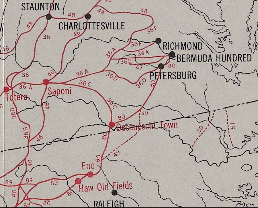
the Occaneechi Trading Path facilitated trade between Native America (and later colonist) communities on the Fall Line and communities in the Piedmont
Source: Yale University Library, Indian Trails of the Southeast (by William E. Myer, 1928)
the Occaneechi Trading Path facilitated trade between Native America (and later colonist) communities on the Fall Line and communities in the Piedmont
Source: Yale University Library, Indian Trails of the Southeast (by William E. Myer, 1928)
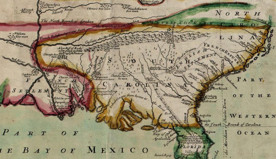
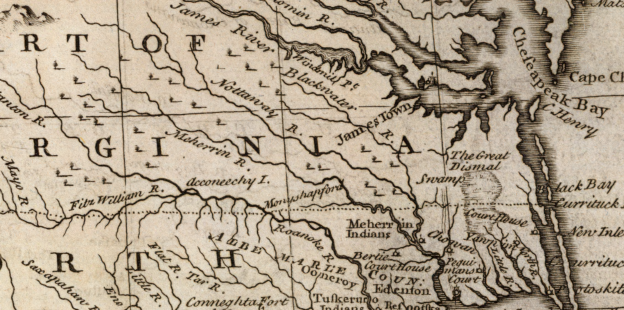
the Occaneechee Trading Path linked customers near the Chesapeake Bay/Pamlico Sound and the Piedmont/Blue Ridge
Source: Library of Congress, A compleat description of the province of Carolina in 3 parts (by Thomas Nairn, 1711)
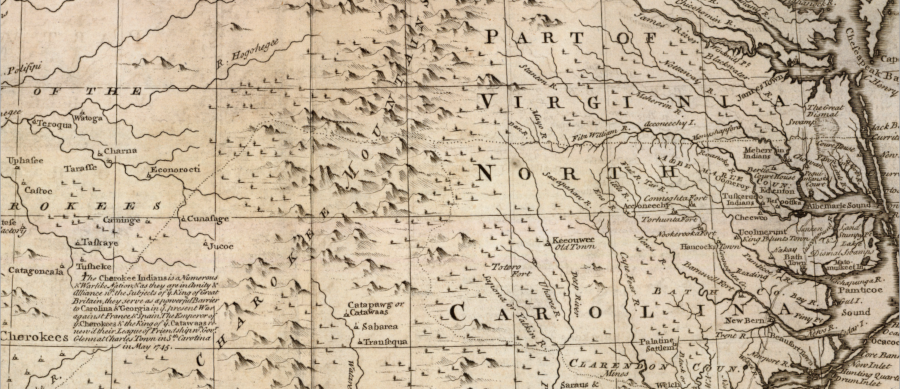
the 1755 Fry-Jefferson map of Virginia recorded the trading path to the Cherokee and western Carolina tribes, with the former trading place on the Roanoke River at Occaneechee
Source: Library of Congress, A map of the most inhabited part of Virginia containing the whole province of Maryland with part of Pensilvania, New Jersey and North Carolina (by Joshua Fry and Peter Jefferson, 1755)
a Native American trail connected Currituck to the Cherokee
Source: David Rumsey Historical Map Collection, A new & accurate map of the provinces of North & South Carolina, Georgia &c. (Emanuel Bowen, 1747)