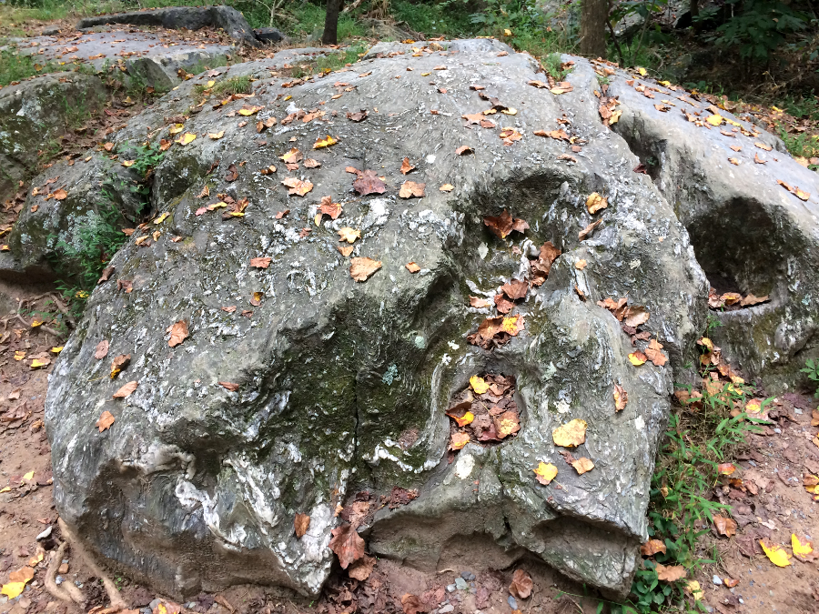
folds in metamorphosed sediments exposed at Great Falls reveal the power of various orogenies (mountain-building events) that shaped Northern Virginia
folds in metamorphosed sediments exposed at Great Falls reveal the power of various orogenies (mountain-building events) that shaped Northern Virginia
On the western edge of Northern Virginia, located in the core of the Blue Ridge, are a dozen rock units older than one billion years. These rocks are believed to have cooled at different times over 150 million years into solid form after chunks of continental crust collided in the Grenville Orogeny ("orogenies" are mountain-building events).1
The Grenville Orogeny expanded the craton that has the Canadian Shield at its center. It was part of a supercontinent known as Rodinia, with various chunks of continental crust that formed one giant landmass. Rodinia was one of five supercontinents that have formed over the lifetime of Earth.
The basement of Virginia, the bedrock that today is buried underneath at least the western half of the state, was created when chunks of crust were pressed together over a billion years ago.
During the Grenville Orogeny, Northern Virginia may have resembled modern-day Nepal. The 1.2-1.0 billion year old gneiss, granite, and "metagranitoid" rocks are exposed today on Old Rag Mountain, and along Skyline Drive in outcrops revealing the core of today's Blue Ridge. There are blue quartz crystals in the Old Rag Granite, incorporating the titanium-rich minerals ilmenite and rutile.2
For 250 million years, the mountains in Rodinia eroded away. About 750 million years ago, the part of Rodinia including what is now Virginia began to split up. As cracks formed in the crust, lava rose up from depth in a rift valley and solidified into what is now the Mount Rogers Complex near the North Carolina border. In what is now Northern Virginia, molten rock intruded into the Grenville-age basement complex. The intrusions cooled into different plutons and a batholith called the Robertson River Igneous Suite.
Around 600 million years ago, the crust thinned and stretched again. New cracks opened up in Northern Virginia, blocks of Grenville-age granite were uplifted and dropped, and basins formed on top of the gneiss/granite/granitoid rocks as Rodinia pulled apart and opened up the Iapetus Ocean basin. Rivers that were constantly eroding the surface carried sand and mud short distances into those basin valleys. Those sedimentary deposits were later heated and squeezed by tectonic forces, and the metamorphosed sediments are known today as the Swift Run Formation. Further south, rivers reached the ocean and the marine deposits are called the Mechum River Formation.
The supercontinent of Rodinia broke apart. Northern Virginia was on the edge of the remnant known as Laurentia, next to the new and expanding Iapetus Ocean. As the crust thinned, magma pushed through cracks to the surface. It covered the Grenville-age igneous rocks and the sedimentary formations in the basins about 570-550 million years ago. The coating of black lava could be compared to chocolate sauce coating an ice cream cone, except the sauce erupted from below via feeder dikes.
Enough lava reached the surface to cover 4,000 square miles. It spread out in separate flows, some as much as 100-feet thick. The different layers were later exposed and eroded at different rates, forming the modern "face" of Stony Man in Shenandoah National Park.
Further east, volcanoes spewed forth as well. At least one small one erupted near Maryland, spreading glassy lava and welded tuffs across the landscape, but the flood of basalt is the primary evidence remaining in Virginia of the time when Rodinia rifted apart.
Some of the continental flood basalt that cooled on land formed columnar joints. Some of the lava is in distinctive shapes that resemble pillows, indicating the lava emerged underwater at the edge of the rifting continent.
The lava is known as the Catoctin Formation. Much later after the igneous lava cooled, the Blue Ridge and its lava coating were buried deep enough to metamorphose the plagioclase, pyroxene, and olivine minerals to form epidote. That mineral has a distinctive color, and the metamorphosed Catoctin Formation is often described as "greenstone."
The Catoctin Formation and underlying Blue Ridge has been moved laterally as well as vertically, and compressed to 60% of its original width. Though the eastern edge of the Blue Ridge is now defined by Manassas, Warrenton and Charlottesville, the pillow basalts underneath the Iapetus Ocean did not emerge there 570 million years ago. That basalt was extruded at the edge of Laurentia about 40-75 miles southeast of today's Blue Ridge, widening the chunk of continental crust.
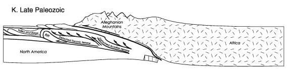
Over 200 million years later in the Alleghenian orogeny, Laurentia collided with Gondwana (Africa). The impact cracked off the edge of Laurentia, thrust a slice of rock to the northwest on top of other Grenville-age rocks, and folded/squeezed the Blue Ridge. The 24-mile wide section that ended up between Monticello and Rockfish Gap along I-64 today was originally 40 miles wide, when located around Richmond.3
The crustal plate with Virginia has also been twirled. Before the Alleghenian Orogeny, when the Catoctin Formation was extruded originally on top of the core of the Blue Ridge, what today is "east" was "south." Laurentia was below the Equator and near the location of modern-day Antarctica, facing towards the South Pole.4
After the Catoctin Formation cooled at the edge of the Iapetus Ocean 550 million years ago, a rise in sea level (or a drop in the continental crust) put the lava underwater. Rivers deposited quartz-rich sand on top of the Catoctin Formation, creating a sedimentary layer known today as the Weaverton Formation.
After another increase in sea level, the shoreline moved further "west" (using the modern direction). Barrier islands formed offshore, creating a lagoon in which only lighter silt particles reached the bottom. The mud is now called the Harper's Formation. It settled on top of the sands that became the Weaverton Formation, which were on top of the 550-570 million year old Catoctin Formation, which was on top of the older Swift Run Formation which was on top of the 1.2-1.0 billion year old core of the Blue Ridge.
Another relative rise in sea level moved the lagoon westward. Barrier islands developed on top of the mud deposits, and the beach sands formed the Antietam Formation. In those sediments, a worm of some sort excavated vertical burrows. Sandstone from the Antietam Formation was later washed down the Potomac River to Alexandria, and well-traveled cobbles can be recognized by those Skolithos burrow fossils.
Sea level kept rising. The Weaverton, Harpers, and Antietam formations, the transgressive sequence of sediments known collectively as the Chilhowee Group, were covered by the portion of the Iapetus Ocean known as the Sauk Sea.
Marine sediments at the bottom on the Sauk Sea formed from the calcium carbonate shells of foraminifera and other tiny plankton, in the same way today similar layers of limestone are forming near the Bahamas. The limestone and dolomite now exposed in the Shenandoah Valley was thrust westward in the Alleghenian Orogeny with minimal metamorphosis, but at some point the Chilhowee Group sediments were metamorphosed into quartzites and phyllites.
Some of the Chilhowee Group sediments covering the lava are exposed at Thoroughfare Gap. Travelers coming from the Shenandoah Valley and headed east on I-66 will see a cliff of white quartzite as they approach the Fauquier County/Prince William County border.
While driving through Thoroughfare Gap, a careful observer will note that the sedimentary layers of sand were tilted on their edge when the pressures of continental collisions metamorphosed the sandstone into harder quartzite. The harder metamorphic sandstone, the white quartzite, is slower to erode. Mother Leathercoat Mountain and Pond Mountain form cliffs that bracket the gap eroded by Broad Run.
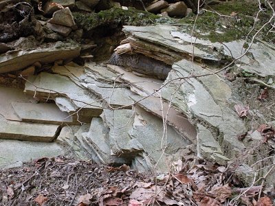
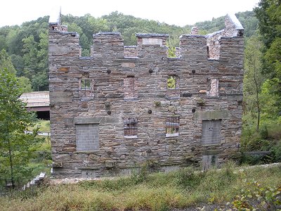
the Weaverton Formation metamorphosed into quartzite (showing layering of original sediments) that was used to build Chapman/Beverley Mill at Thoroughfare Gap
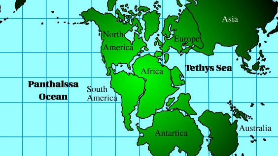
The ocean next to Virginia 600 million years ago, after Rodinia broke up, is called the Iapetus Ocean. In Greek mythology, Iapetus was the father of Atlantis, so the older ocean is named after the older mythological figure. The Iapetus Ocean disappeared as continental plates shifted around and recombined as Pangea. After Pangea broke up, a younger ocean - the Atlantic - formed between Africa and North America.
The Iapetus Ocean 600 million years ago was to the south of the Virginia coast, not to the east as we see today. Continents spin as well as migrate, and Virginia has rotated 90 degrees counter-clockwise in the last 600 million years. Massive amounts of limestone accumulated in the bottom of that sea,
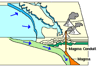
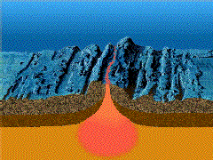
Juan de Fuca plate of ocean crust being subducted under North American plate
of continental crust, resulting in Cascade volcanic range in Oregon/Washington
Source: USGS Cascades Volcano Observatory
 The Iapetus Ocean formed, splitting Laurentia from Gondwana, after the supercontinent Rodinia split up. A ribbon of crust on the edge of Laurentia may have split off in a second tectonic motion.
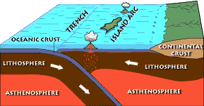
Then the tectonic plates cracked again and chunks of Iapetus Ocean crust moved towards Laurentia. The ocean began to shrink, as oceanic crust was subducted or pushed underneath the adjacent plate, comparable to how the Juan de Fuca plate is being pushed under the continental crust near the coasts of Oregon/Washington today. A deep trench formed in the Iapetus Ocean, and the melting crust created an arc of volcanic islands comparable to modern Indonesia, Japan, or the Aleutian Islands. Slowly, as the subduction conveyor continued to shrink the ocean crust, the ribbon of Laurentia and that island arc got closer to the chunk of crust that included Virginia.
The deep trench underneath the Iapetus Ocean filled with sediments eroding from both the volcanic island arc and the continental crust called Laurentia. Ultimately, the island arc was thrust against the crust in the Taconic orogeny about 450 million years ago. The silica-rich trench sediments and the magma-rich island arc, known today as the Western Piedmont or Potomac terrane, were uplifted into mountains similar to the Coast Ranges of California/Oregon/Washington. The mountain "roots" were baked and squeezed (metamorphosed), and stuck onto the eastern side of the continent like toothpaste.
In the process, much of the trench sediment and volcanic island materials, especially in the roots of those mountains, were converted into a hard metamorphic "graywacke" rock that forms the modern Piedmont. At the time of the Taconic orogeny about 450 million years ago, those sediments were pushed up into the first version of Appalachian Mountains (Appalachians 1.0).

Taconic orogeny
Source: USGS America's Volcanic Past
Most of those mountains have washed away, creating layers of sedimentary rocks to the west that later would be exposed in Massanutten Mountain. In Northern Virginia, remnants of those uplifted and metamorphosed sediments, slices of the Iapetus Ocean trench are exposed today at Great Falls on the Potomac River and at construction sites throughout the Piedmont. The Fairfax campus of George Mason University was built on top of the Iapetus Ocean bottom.
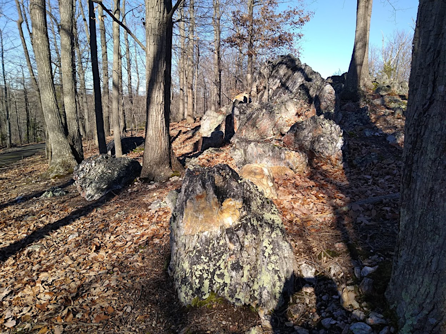
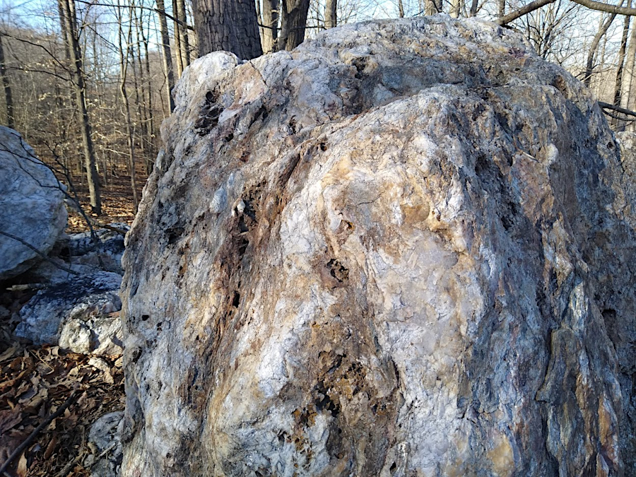
Underneath those mountains, crust melted to form more granite about 475 million years ago. That ancient Occoquan granite rock, emplaced at the start of the Taconic orogeny, is exposed now at the Vulcan "Graham" quarry where Route 123 crosses the Occoquan River (just north of the town of Occoquan), on the shoreline of the Occoquan Reservoir, and at Lake Jackson in Prince William County.5
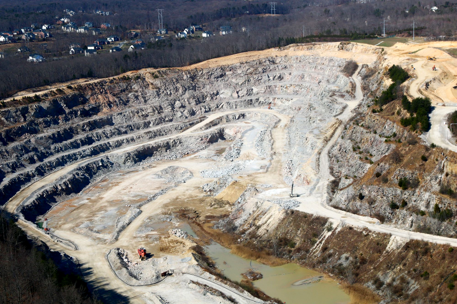
the quarry at Occoquan is mining granite roots of mountains uplifted in the Taconic Orogeny 475 million years ago
Source: Historic Prince William, Rock Quarry - #89
The Taconic orogeny that squished and mushed the trench sediments onto the eastern edge of Virginia may have provided an early "push" that broke the Blue Ridge free from its underlying basement rock, before a later collision shoved that block of crust tens of miles to the west.
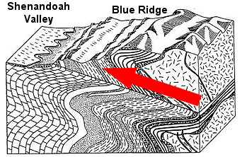
thrusting of Blue Ridge to the west
Source: Virginia Department of Environmental Quality: Natural Resource Education Guide, Virginia's Minerals & Energy Resources
As the Iapetus Ocean closed, Virginia experienced three major collisions between 450-200 million years ago. The ribbon of Laurentia (the Western Piedmont or Potomac Terrane), island arcs like Japan or the Aleutians (with Gondwanan deposits), and then finally the Gondwana plate itself (with the continent of Africa) banged into what is now the eastern coast of North America. Each collision pushed up mountains in orogenies called the Taconic, the Neo-Acadian, and finally the Alleghenian. After each orogeny, the high mountains ranges created in Northern Virginia eroded away.
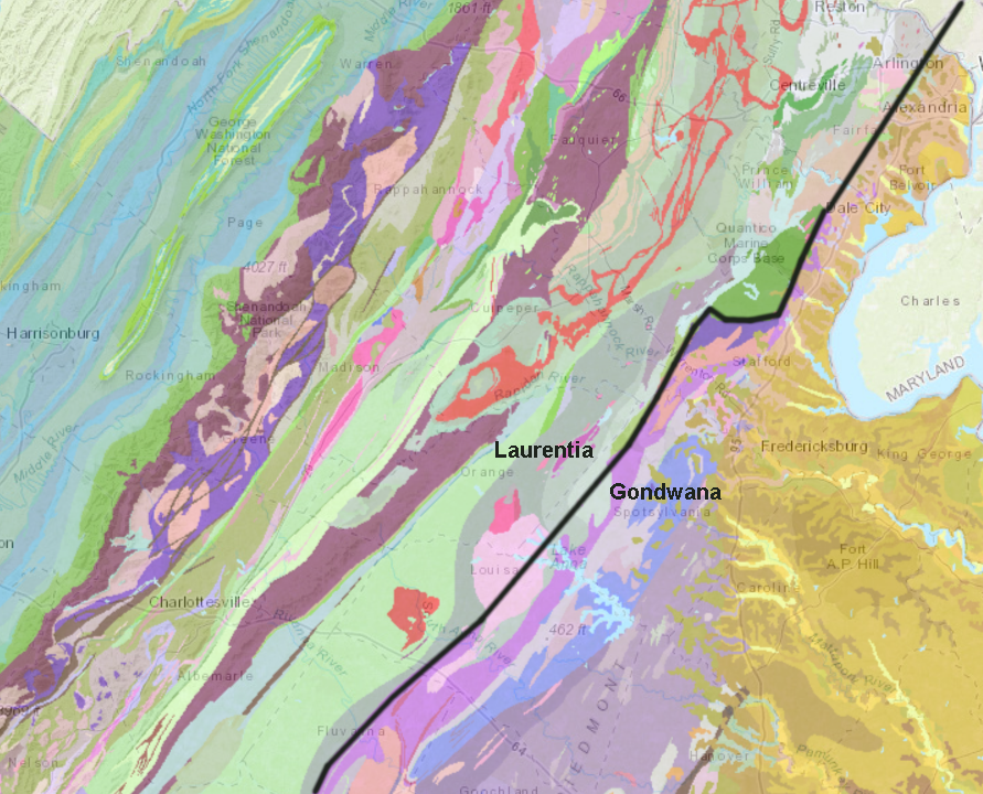
the black line between the Chopawamsic and Western Potomac terranes may approximate the suture where crust from Gondwana is attached to crust from Laurentia
Source: Virginia Department of Energy, Geology Mineral Resources
Today we can see the sediments that eroded westward from each of the three mountain-building collisions. The sediments deposited on the western edge of the mountains are exposed in West Virginia roadcuts, as well as at Massanutten Mountain. Sediments deposited to the east by each orogeny, but the eroded residue from the Taconic and Neo-Acadian are less visible.
Many of the sediments that washed off towards the east into the Iapetus Ocean were scrunched up (metamorphosed) in the final Alleghenian orogeny, in the collision of Laurentia (North America) and Gondwana (Africa). The Alleghenian orogeny, which "wrinkled" the layers of sediment across Virginia and created the tilted rocks in the Valley and Ridge physiographic province, left deposits east of the Blue Ridge which are clearly visible.
In the Alleghenian orogeny, the billion-year old Blue Ridge granite (with its 600-million year old lava coating) was thrust on top of the 500-million year old limestone and younger sediments that had formed in the shallow Sauk Sea on the edge of Laurentia. We don't really know how, and we're not positive what is underneath the Blue Ridge... but there are faults on the east and west sides today, and the Blue Ridge rocks did not develop next to the current neighbors. It was transported there, somehow.
At the end of the Alleghenian Orogeny about 200 million years ago, at the end of the Permian Era, Northern Virginia was in the middle of a supercontinent known as Pangaea, with a mountain range equivalent to the modern Andes.
piling on: the Allegheny Mountains of Northern Virginia, back in the day
Source: US Geological Survey, Regional Tectonic History of Northern Virginia (Figure 2)
In the course of the island arc and continental collisions, the soft muds and sandy sediments that had accumulated on the shoreline of the Iapetus Ocean were folded and metamorphosed into hard rock. Sand grains melted and silica flowed between the other solid minerals. The injections of silica cooled into blobs of quartz surrounded by the metamorphosed sediments. Gold melted and flowed through the sediments with the silica, ultimately congealing into veins that have been mined in Fairfax, Prince William, and Fauquier counties until the 1930's.
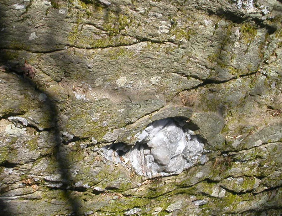
quartz blob in rocks on edge of Scotts Run, west of American Legion Bridge
The quartz nodules, especially the crystalline versions known as jasper and chert, were prized by Native Americans before the Europeans arrived. The rocks could be hammered together and split to form sharp edges. You will probably create comparable conchoidal fractures if you drop a glass Coke bottle and the thick bottom breaks. Glass bottles, like quartz, are made from silicon dioxide (silica).
Through trading networks, Northern Virginia natives also acquired rhyolite (volcanic rock) from Maryland's Blue Ridge and copper from the Great Lakes area. Using the local rock resources, skilled artisans flaked stones to create a wide range of scrapers and points (including "arrowheads") for perhaps 15,000 years before John Smith sailed to Little Falls in 1608.
John Smith was the first European known to visit Northern Virginia. With the permanent settlement of Jamestown, the Native Americans in Northern Virginia gained steady access to iron and copper/brass tools. It was far easier to acquire deer/corn and trade for iron tools, than to work with stone and bone to do such tasks as cutting trees.
One measure of the challenge of making useful tools in the Native American way from local rocks: few historical interpreters become skilled enough today to demonstrate "flint knapping."
Can you find Fairfax County on this map of Pangaea, perhaps 250 million years ago?
Source: On the Move... Continental Drift and Plate Tectonics by NASA
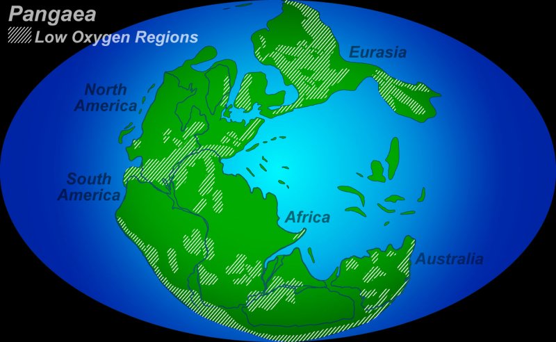
low oxygen levels mark locations of high mountain ranges at end of Permian Era
Source: Reduced Oxygen Contributed To "Great Dying", National Science Foundation news release
The sediments that were scrunched by the collision of Africa with North America have been exposed in modern time. Erosion has reduced the mountains to sedimentary layers, stripped away the overlaying sediments, and exposed the metamorphic rocks formed 200-250 million years ago. You can see the baked/scrunched rocks at Great Falls in the Potomac River, where the Potomac River is carving away at the hard crystals formed by a continent-sized pressure cooker. The rocks have been quarried as building stone. "Rock Creek" in DC is lined with old quarries, and "Potomac bluestone" is still used for decorative walls throughout Northern Virginia.
Potomac bluestone used to decorate building at Tysons Corner
Great Falls has been described by the US Geological Survey:6
Not very poetic, but it does explain why the falls exist. Waterfalls exist where the bedrock is harder than whatever is downstream. Falling water cuts a relatively deep hole/channel downstream, but is unable to carve an equally-deep channel into the hard bedrock. The Potomac River originally carved a channel into the Coastal Plain sediments, and the waterfall was 9 miles downstream from its current location.
The actual contact between the soft sediments and the hard bedrock is on the upstream end of Teddy Roosevelt island, between Rosslyn and the Kennedy Center in DC. The waterfall has moved in the last 20,000 or so years, as it gradually cut into the hard bedrock upstream. This migration could continue until the Potomac River etches upstream to Seneca Creek. There the bedrock changes to a softer sandstone, and the Great Falls could turn into a series of rapids without dramatic individual drops .
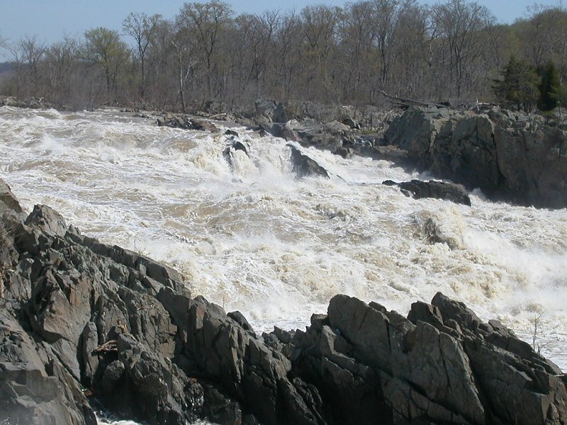
Great Falls, about 200 million years after sediments were baked/scrunched into metamorphic rock
Draw a line from Fredericksburg, through Occoquan to Georgetown in DC, and you have a rough approximation of the Fall Line. It is really a zone rather than a line, nine miles wide where the Potomac River crosses it.
What happened to the tall mountains, the Andes of Northern Virginia that were pushed up at the same time the ocean sediments were metamorphosed? Water and wind etched the mountains away, rapidly in major storms and gradually at other times. In addition to the physical weathering, the crystals in the mountain rocks absorbed atoms and molecules, changed shape, and altered into forms that dissolved in water.
Between physical and chemical weathering, perhaps 25,000 feet of rock has been stripped away as the once-towering mountains eroded to the current flatness of Northern Virginia. It took many years of erosion, and the process continues today. The Potomac River currents that tear at the bedrock of Great Falls, and the energy of other streams in Northern Virginia, are still cutting away particles of rock and carrying them downstream.

pebbles at Tysons show it was once the bed of the Potomac River, but differential erosion has left it as the tallest spot in Fairfax County and suitable for communications and water towers
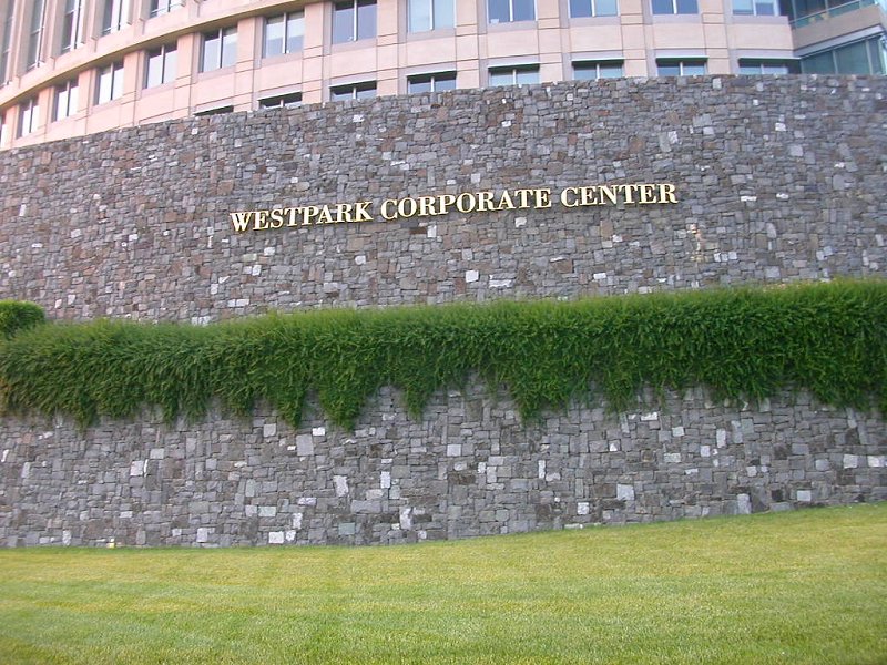
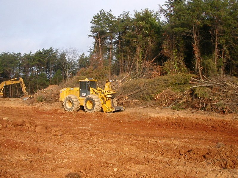
All the rocks of Northern Virginia, not just the bedrock underneath rivers, are also decaying or weathering. The now-scrunched and metamorphosed ocean sediments are exposed on the surface today between I-95 and Greenbriar (on Route 50), Centreville (on Interstate 66), and Manassas (on Route 234). In that zone, the minerals of the metamorphosed rock are turning into clay. The decomposing rock, known as "saprolite," is normally so rotten that bulldozers can shove the earth without requiring drilling or blasting.
red clay in the Piedmont physiographic province, colored by iron in the soil
Grab a handful of dirt from a construction site on the Fairfax Campus, and note the color of the soil. The saprolite often includes flakes of shiny mica, as well as clay minerals that allow you to squeeze the dirt into a sticky ball. Note the reddish color too. That comes from iron in the soil - the crust of continents is not as rich in iron as the basalts on the ocean floor, but there's plenty of iron oxidizing to rust in the soil of Northern Virginia.
Ever wonder why bricks were red? The iron is oxidized in the kiln as the clay is baked. To get yellow or other-color bricks, the manufacturers can adjust the amount of oxygen in the kilns, as well as the temperature and the source of clay that is baked into brick. Of course, owners can always paint brick too, but that creates a major maintenance headache. Unpainted brick does not fade or peel, and need to be repainted.
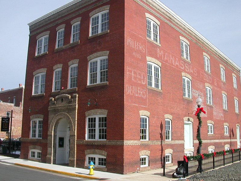
brick Candy Factory building in Old Town Manassas
Take a look at a sidewalk or gutter on campus, or on a city street in Northern Virginia. See any flaked or cracked places? The pieces of concrete, like natural rock, are going to move downhill, downstream, until ultimately reaching the Atlantic Ocean. A particle of sand in front of the George Mason statue next to the Johnson Center could end up at Virginia Beach in a few decades, and could be pushed all the way to the continental shelf and then the bottom of the Atlantic Ocean. When you measure time in millions of years, solid earth can be reshaped just like a bar of soap can disappear.
Have you noticed that this story is still missing a key piece? The mountains washed away over 200 million years, but where did that rock go? Look east of Interstate 95, or west of the Shenandoah Valley, and you can see the sediments. In West Virginia, roadcuts expose the layers of sediment that piled up as the mountains eroded. Some of the rocks of the ancient Appalachian Mountains stretch all the way to Illinois.
To the east, the rocks that were once part of the Appalachians now form the Coastal Plain, the flat land between I-95 and the Atlantic Ocean. Sediments that eroded from the ancestral Appalachian Mountains, which were once 20,000 feet higher than today, stretch over 30 miles to the east.
The hard crystalline rock exposed at Great Falls exists across the Piedmont, but lies deep underneath the decaying rock. The hard rock is buried too deep to make most quarries economic in the Piedmont, except in the diabase regions of the Triassic basins. (In the Coastal Plan, quarries extract sand and gravel, and blasting is not required.) The Coastal Plain also includes some other sediments that were deposited from the ocean, when sea levels were higher and the Atlantic Ocean coastline was roughly the current location of I-95.
Seashells in those sediments resulted in some layers of limestone/marl in the Coastal Plain. Otherwise, Northern Virginia has only a few outcrops of sedimentary limestone, in western Loudoun County. If you visit Statuary Hall in the US Capitol, note the columns - they were carved from Loudoun's "Calico Rock," a form of limestone that resembled marble.
Outcrops of any hard rock are rare east of Alexandria, Dumfries, or Fredericksburg. The "rock" at Freestone Point (now part of Leesylvania State Park) was readily available, but the sand grains in the stone were only loosely cemented together. Further south at Aquia Creek, the builders of the Capitol and the White House found an outcrop of slightly more-solid stone that was easy to transport by boat (imagine hauling big blocks of stone over dirt roads in 8-mulepower wagons, after rain turned the roadbed to mud...). However, the stone was weak, and later covered by other materials to prevent the sandstone from flaking away.
Most of the wealthy gentry in colonial Virginia resorted to baking clay into bricks to create artificial building stones of the desired size. Under the heat of wood-fueled fires, the clay vitrified and became impervious. (Your toilet may be formed through the same chemistry.) Next time you visit Gunston Hall, home of George Mason, note what he sort of material he used. The flexibility, availability, and cost of brick has made it a popular choice for three centuries of construction in Northern Virginia.
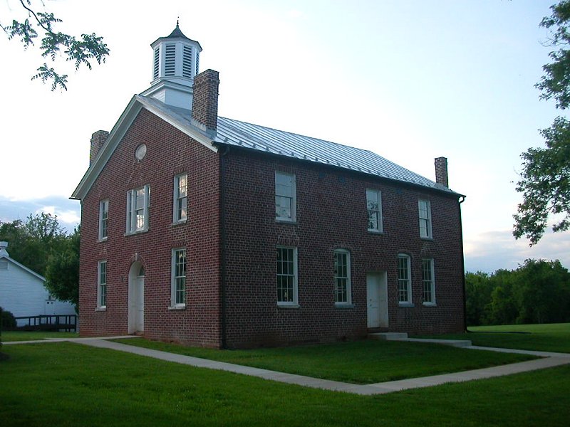
Brentsville Courthouse, Prince William County (built in 1822... see any limestone?)
George Washington found a very creative solution to meet his desire for building an impressive mansion that was unique in the neighborhood. He had his workmen carve the wooden exterior siding into the shape of blocks. They mixed sand into the paint, and - voila! a stone house emerged at Mount Vernon.
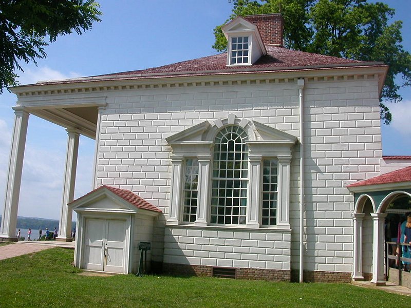
fake stone at Mount Vernon, home of a savvy George Washington
Northern Virginia has experienced no collisions with continents since the Triassic Era breakup of Pangaea, so the Coastal Plan had no pressure to push up mountains. The mountains were uplifted on what is now the western edge of Northern Virginia, and everything to the east of the Blue Ridge is relatively flat. Water flows downhill, so rivers and streams in Northern Virginia flow from west to east. The Potomac River reaches sea level near Mount Vernon, but tides affect the river all the way to Georgetown. Wind and tides can cause the Potomac River to have a westward current at times.
The Widewater Peninsula in Stafford County is particularly flat. However, not far away the Crows Nest area has significant "topographic relief" (the distance between a nearby high/low point). The hills of Northern Virginia may be just "bumpy" to someone familiar with the Rocky Mountains, but even a little topographic relief can have a major impact on transportation routes. After all, would you want to carry a heavy load up and down a hill, or would you be willing to go slightly out of your way to avoid that work?
Why the difference? Some sediments are loosely bound, and they erode easily when a stream shifts and cuts into the sediments. Other sediments are more resistant, so they form the bluffs and low ridges along the Potomac River shoreline in Northern Virginia.
The ridges/hills in Northern Virginia within the Coastal Plan reflect how different sediments were "glued together" by heat/pressure of overlying sediments, or by chemical reactions among the minerals, while the Blue Ridge mountains on the western boundary were originally pushed up in an "orogeny" when Africa collided with North America. (The Blue Ridge today has significant topographic relief compared to the Culpeper Basin because, over time, the sediments in the basin erode faster than the crystalline rocks in the Blue Ridge. Differential erosion plays a large part in shaping the topography of Northern Virginia, but the continental collisions/breakups determined which rocks would be located on the east vs. west edges of Northern Virginia.
The eroding sediments have accumulated at the trailing edge of the North American "Cheerio," as the content has moved westward in the last 180 million years since Pangaea cracked up. In contrast, sediments that wash off the Cascade and Coast Range mountains pile up on the Oregon/Washington coast are "run over" as the continent drifts westward.
Now it's time to tell the tale of the Atlantic Ocean.
The supercontinent of Pangaea broke up about 220-180 million years ago. It was not an overnight event - you can see an equivalent breakup underway now in eastern Africa, where a great rift valley in Kenya and the Red Sea are slowly splitting up Africa. A magma-spewing ridge has not formed yet in eastern Africa, but wait a few tens of millions of years and a new crack down to the mantle may be obvious.


When Pangaea split about 200 million years ago, it cracked in multiple places, like a souffle as it cools. If you don't cook souffles these days, try pulling at two edges of a block of Jello. You'll see multiple cracks form in the surface of the gelatin, until one finally becomes dominant and the block of Jello splits along that line.
As Pangea split into Africa/Europe vs. North America, the crust became thinner and thinner as the crust pulled apart. One of the cracks became deeper than the others, and intersected the molten rock underneath the crust. What we now call the Mid-Atlantic Ridge formed, but initially there was no Atlantic Ocean. The magma welled up at the new expanding ridge (or "divergent center"), pushing Europe/Africa away from North/South America. Cooling magma oozing from the crack in the crust formed the basalt (iron-rich) floor of the Atlantic Ocean. Each year, the ocean gets a few centimeters larger to the west of the ridge, pushing the North American Plate closer to China. That's why the ocean bedrock is so young, compared to the billion-year old silica-rich crust in the Blue Ridge and Canada.
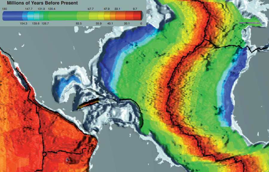
the oldest part of the Atlantic Ocean seafloor is next to Virginia, while the most-recent bedrock just emerged as lava at the Mid-Atlantic Ridge
Source: Scripps Institution of Oceanography, A digital age map of the ocean floor
Did I mention that the continental breakup created more cracks than just the one that formed the Atlantic Ocean? One crack failed to become the center of the "new" ocean, but it still is obvious on the Northern Virginia landscape. Go to Centreville on Route 29 and look west, and you'll see a vista... because there is a valley between Centreville and the Blue Ridge mountains. That valley is one of the cracks, formed in the Triassic Era when Pangaea split up, that could have become the Atlantic Ocean.
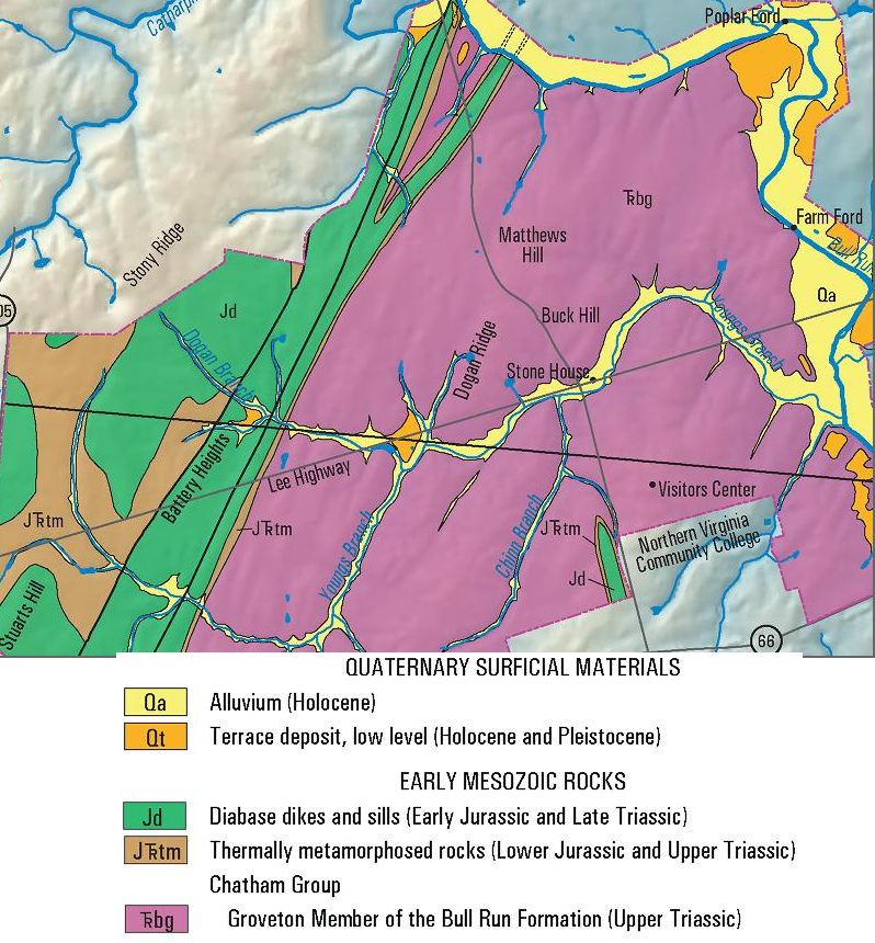
geology of Manassas National Battlefield Park
(Stonewall Jackson's position at Battle of Second Manassas was on slower-to-erode, topographically-high Stony Ridge)
Source: US Geological Survey, Geologic map of the National Parks in the National Capital region, Washington, D.C.; Virginia, Maryland, and West Virginia
The crack in the valley west of Centreville could have become the Mid-Atlantic Ridge, if the magma upwelling had continued there. In that case, the boundaries of the continental plate would have been in a different place. Everything to the east of Centreville would have become part of Europe, and what is currently Northern Virginia would have started at Route 15. (If you like old Marlon Brando movies, "It could have been a contenda...")
The valley in Northern Virginia formed by the thinning crust that cracked 180 million years ago is known as the Manassas Basin, or the Culpeper Basin. The crack opened up in the Triassic Era, a time when dinosaurs wandered around Northern Virginia. We find their tracks in the sandstones of various Triassic-era basins along the east coast of North America, stretching from Georgia to Nova Scotia.
The basin has a fault on the western edge, and the land dropped furthest down at the base of the Blue Ridge. (A "fault" is a line where, on either side, the earth has moved in different directions.) On the east side of the basin (marked roughly by Greenbriar shopping center on Route 50, Centreville on Route 29, and the armory near Manassas on Route 234), the land tilted as the basin formed to the west. Streams poured sediments into the low-lying area and the weight of new sediments compacted older deposits into what we see today, purple-red sandstones.
Some are used as building materials, such as the Smithsonian "castle" on the National Mall in DC. Both the Stone Bridge over Bull Run and the Stone House at Manassas National Battlefield Park used Triassic sandstone. If you look downstream from the modern Route 29 bridge over Bull Run, you can see how the layers of sediment that washed into the Culpeper Basin dip down towards the west.
The "brownstone" houses in New Jersey/New York are made of Triassic-era sandstone. The brown color develops as the iron in the sandstone oxidizes, after stones are cut and the interiors are exposed to the atmosphere.
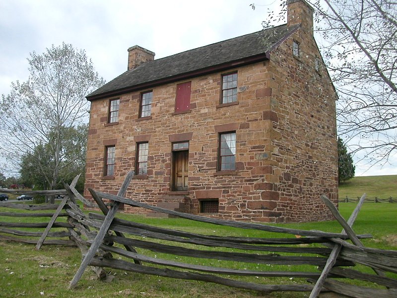
Stone House at Manassas National Battlefield Park
One factor to consider when buying a home in Northern Virginia - radon. It is a radioactive gas emitted as uranium decays. A tiny percentage of uranium is mixed in with the rocks in Northern Virginia. (What may be the largest deposit of uranium in North America is located at Coles Hill in southern Virginia, near where Route 29 crosses the North Carolina border.) Accumulation of radon inside houses, where people could breathe enough to cause lung damage, seems to be a particular concern in the zone with Triassic sandstones - perhaps because the sedimentary rock is permeable enough to permit the gas to migrate. When we build air-tight houses and block the escape of the radon, we may trap enough to cause a health risk.
As the earth's crust stretched in the Triassic Era, it became thinner in the basin. Hot magma broke through the sediments and at times flowed out on the surface of the valley - just as magma erupted in what became the Mid-Atlantic Ridge. At other times, the hot magma was injected into layers of sandstone and squeezed sideways, without erupting on the surface. (Imagine using a needle to inject chocolate from the bottom into a layer cake, and having the chocolate push between the layers of cake without squirting out the top.)
Geologists refer to the magma flows that cut through rock layers as "dikes." The layers of magma that flowed sideways are called "sills." The cooled magma, known as "diabase" or "traprock," is rich in iron, and is much darker in color than the surrounding sandstones.
As modern erosion cuts through the sediments, the magma sills are exposed. The sills are slower to erode, because the diabase (an igneous rock) is much harder than the sandstone (a sedimentary rock). In addition, some sandstone next to the dikes was baked/metamorphosed into harder "hornfels" as the magma was initially injected.
The sills form modern ridges within the Culpeper Basin. Drive north on Route 28 from Dulles airport to Route 7, and the ridge on your left (west of Route 28) is a diabase sill. Commuters in Prince William County near Gainesville who drive Devlin Road between Linton Hall and Wellington will see a similar sill on their west.
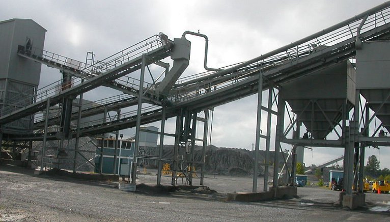
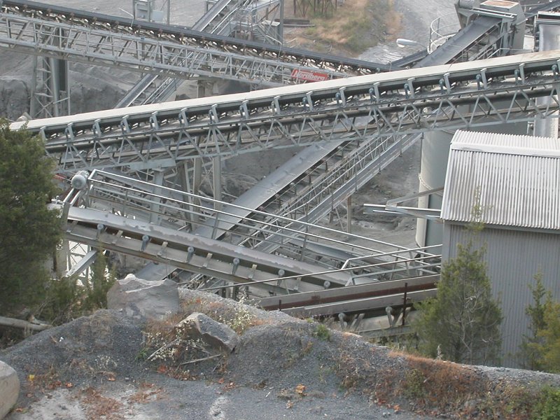
equipment used for separating crushed rock of different sizes at Luck Stone's Bull Run quarry
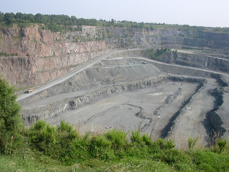
At one time, that ridge was planned to be developed as a quarry. Almost all the quarries in Northern Virginia (except the granite quarry near Occoquan) are excavating the diabase and crushing it to the desired sizes, before mixing the rock with cement/sand to form concrete - or with asphalt, for road pavement.
You might think that quarries would quickly fill up with water, but in diabase quarries pumping costs can be minimal. The diabase rock is impervious (watertight) as well as resistant to pressure, which is why the material is valuable for construction. (Local sandstone, if mixed with asphalt, would crumble under the weight of tires and cause cracks in a road.) Rainwater and an occasional fault in the diabase are the primary sources of water entering a Northern Virginia quarry.
diabase quarry behind Unity Reed High School near Manassas Mall
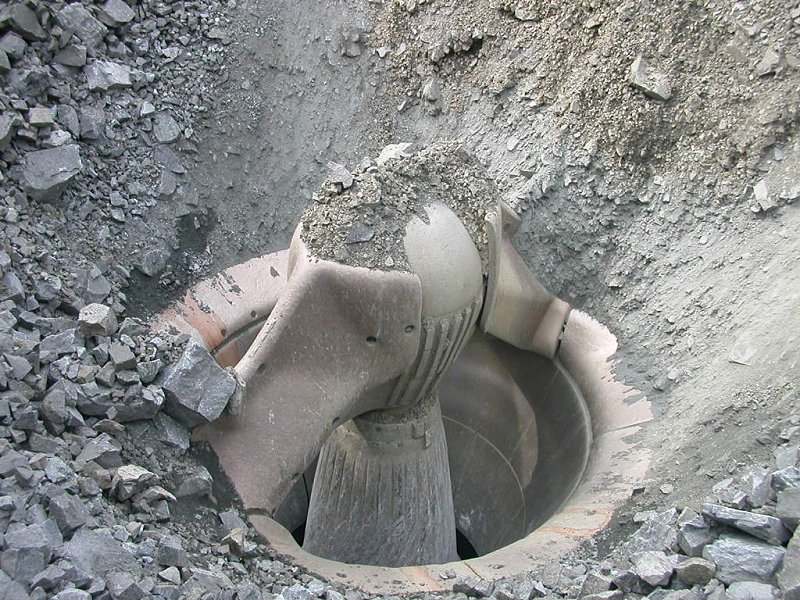
how to make big rocks into little rocks, via a massive crusher
how to sort rocks into desired sizes: rock crushing equipment at diabase quarry on Route 29, western edge of Fairfax County
The diabase quarry behind Unity Reed High School near Manassas Mall is actually located on top of the dike, where molten rock spurted to the surface at what could have been near-supersonic speeds around 150-180 million years ago. The quarry owners could excavate forever into that source material, unlike other quarries where the sills are of a limited thickness. However, the costs of hauling the rock to the surface are a factor in the economics of quarry operations. Vulcan, the quarry owner, is seeking to open a new quarry near Nokesville with rock at the surface, and planning to close the existing quarry in Manassas in the next 20 years or so.
Quarries are located where the resource is located, of course. There are no diabase quarries in Northern Virginia outside the Culpeper Basin, because the diabase is not exposed near the surface in other areas.
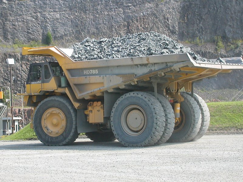
truck in diabase quarry
One other key factor is quarry location is the distance to market. Diabase is a high-volume, low-value product compared to, say, computer chips or oil. Hauling large amounts of rock in dump trucks is expensive. In areas where population is growing, such as Northern Virginia, the construction industry wants to be able to buy from different quarries in order to get the most-competitive price. However, in many cases the closest quarry will get the order because transportation costs are such a high percentage of the total cost. A construction site equidistant from two quarries may be able to stimulate competition.
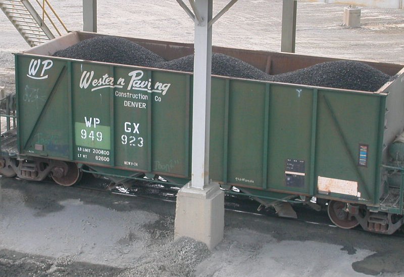
loading diabase into rail car at Manassas quarry (rock 'n rail...)
One advantage of the diabase quarry behind Unity Reed High School is that it is located on a rail line. The rock can be shipped to some construction sites inside the Beltway without the costs of navigating through traffic jams. Each carload of rock is the equivalent of up to 10 dump trucks, so the cost savings are obvious.
The bedrock of Northern Virginia was disturbed by volcanic dikes and sills of diabase, but never interrupted by a kimberlite "pipe." That rock, believed to be squirted up from the top of the mantle, is the source rock ("mother lode") of diamonds. Since Northern Virginia lacks the source rock, there are no diamond mines in our area - but there are some indications of ore with diamond potential in Warren County, west of the Blue Ridge.
Northern Virginia lacks coal and oil/gas resources too. It is possible that these existed at one time, then eroded away in the periods of time for which we have no remaining rocks. Gas exploration under other Triassic basins in Virginia have produced some "shows" of natural gas, but none were productive enough to develop into producing fields.
Any oil that existed prior to the continental collisions was presumably baked away in the metamorphism of that time. Since then, Northern Virginia has not had the necessary conditions for formation of oil or coal deposits.
Bottom Line: fossil fuels are not present in Northern Virginia's bedrock. Commuters in the region depend upon oil and other energy resources from outside the region. Residents and industry depend upon electricity generated by coal, natural gas, and uranium that was extracted elsewhere. In the absence of fossil fuels, and with limited hydropower and wind resources, solar and geothermal energy are the most likely local resources that might make Northern Virginia energy independent.
Northern Virginia east of the Blue Ridge has been covered by the Atlantic Ocean at various times in the last 150 million years. During times of high sea levels in the Cretaceous and more recent periods, sediments eroding off the Blue Ridge were deposited in Loudon, Fairfax,and Arlington counties.
When sea level dropped, those sediments eroded away, ending up on the Continental Shelf. Remnants of sedimentary deposits, dating back to the Cretaceous Period when dinosaurs roamed across what is now Northern Virginia, remain as high points which have not eroded away - yet.
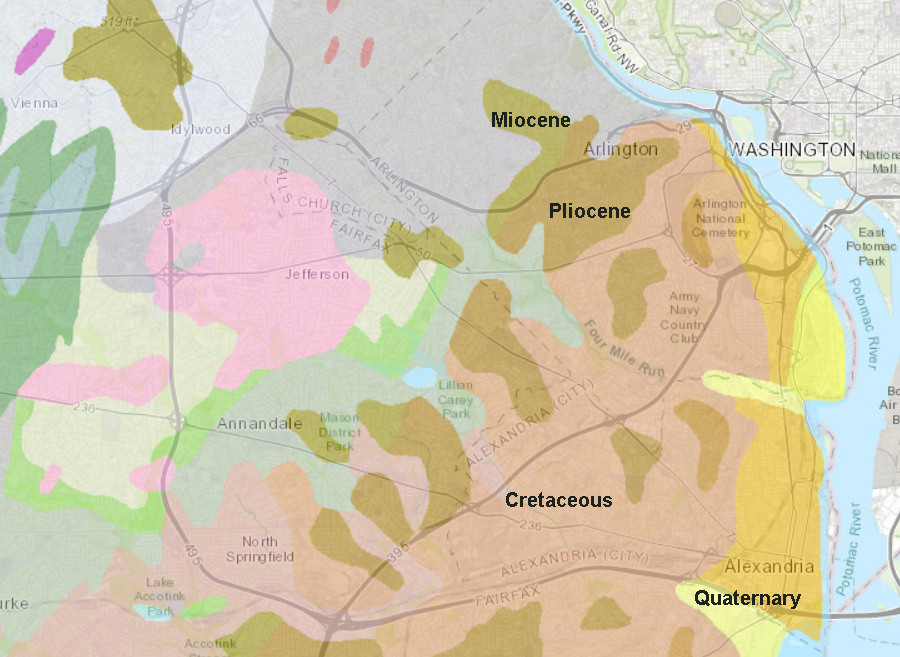
sedimentary deposits dating back to the time of the dinosaurs, and more recent deposits as well, remain on high points in Northern Virginia
Source: Virginia Department of Energy, Geology Mineral Resources
River channels have migrated across the land, excavating in areas with softer bedrock and shifting direction when encountering resistance. The current pattern of clearly-defined river valleys may have been very different in the past. At one time, rivers in Northern Virginia may have resembled the braided channels in the Arctic or the Amazon, with animals crossing multiple shallow streams rather than one wide or deep channel.
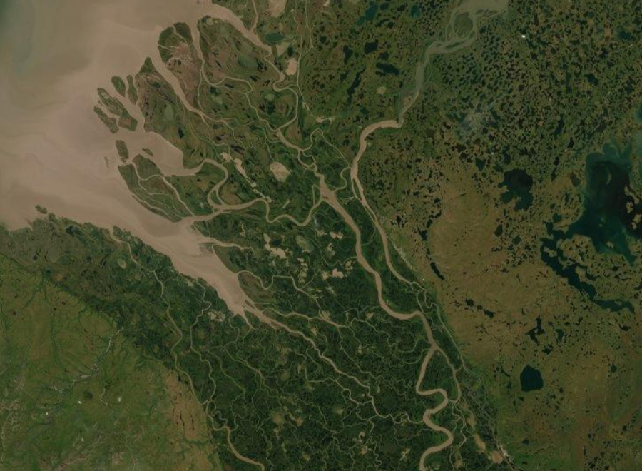
rivers in Northern Virginia may have sprawled across the landscape in the past, with multiple braided channels separated by islands
Source: ESRI, ArcGIS Online
the metamorphic rock of the Western Piedmont terrane is exposed in Blooms Park (City of Manassas Park)
the bedrock of the Western Piedmont terrane was metamorphosed, particularly in the Alleghenian Orogeny