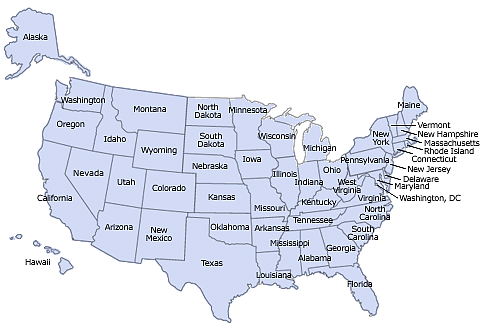
Look at the map of the United States and contrast the shape of Virginia with the shape of other states. You can squint your eyes and morph Virginia into a sort of triangle. Virginia certainly is not a rectangle like Wyoming or Colorado, with four edges defined by latitude and longitude.
Start by looking for the edges of the state on a map that shows the political boundaries of the counties/cities/states, as well as the topography (elevation of the mountains/valleys), and find the corners of Virginia.
People have different opinions when asked to find the four corners of the state, but typically the selections for the southwest and southeast corners are consistent. There are two places chosen most often as the northeast corner of Virginia. The toughest choice: which spot do you pick as the northwest corner?
Source: Color Landform Atlas of the United States, Virginia - County Map
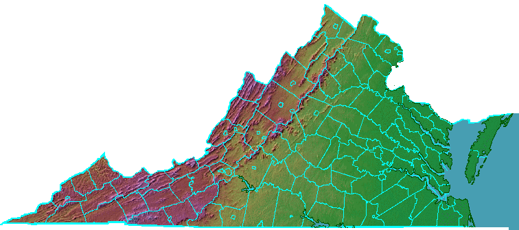
Pretty simple stuff so far, right? This next challenge is a little harder: find the location of Fairfax County in a satellite image (without the political boundaries) of Eastern Virginia:
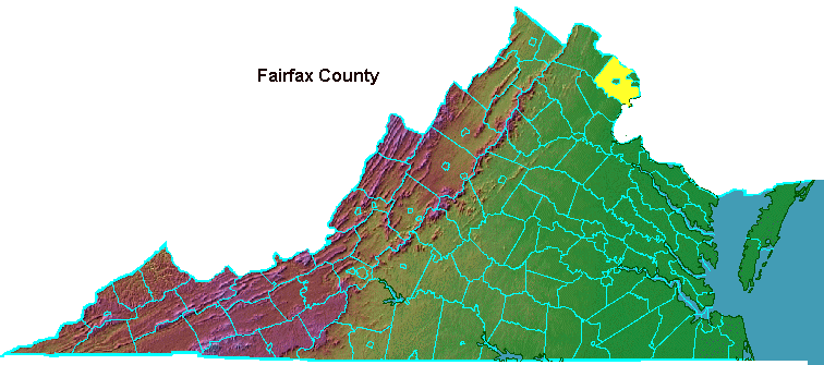
Source: Color Landform Atlas of the United States, Eastern Virginia
Hint: look for the District of Columbia boundaries, across the Potomac River, as a guide. To test if you found Fairfax County, click on the satellite image without the political boundaries.
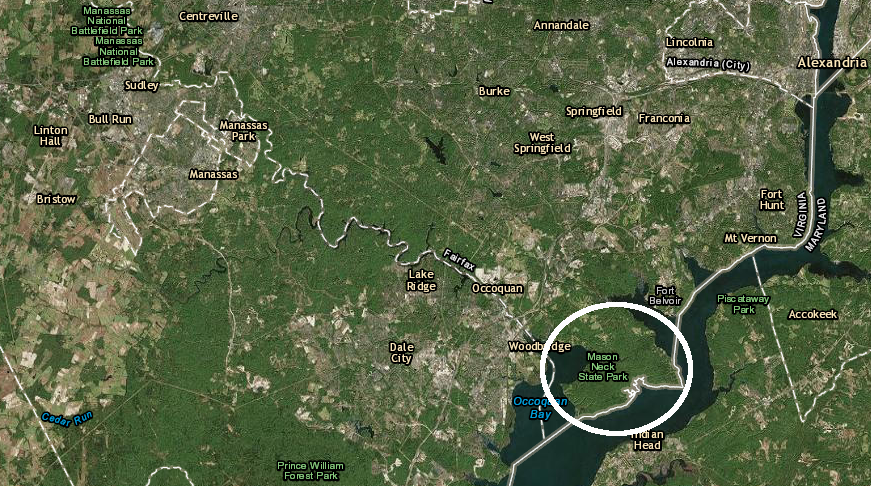
Next, a more-granular challenge: on that map of Eastern Virginia, find Mason Neck. That is the peninsula where George Mason IV finished Gunston Hall in 1759. Check your answer: Mason Neck is circled in white in this ArcGIS Online screen capture, and can also be seen "live" in Google Maps.
George Mason IV built Gunston Hall during the French and Indian War that disrupted the Virginia colony's borderlands between the Shenandoah Valley-Ohio River. By then, Mason Neck was far from the edge of colonial settlement - though even today artifacts made by the Moyumpse (Dogue) tribe on Mason Neck are still being excavated.
The peninsula was on the border with Maryland, and the Mason family owned the ferry that crossed the Potomac River. It also owned the ferry crossing the Occoquan River between Fairfax/Prince William counties. In the 1790's, George Mason IV's son Thomas built a wooden bridge across the Occoquan River, and a corner of Prince William County is still known as Woodbridge. He charged six cents for a person to cross and six cents for a horse; toll roads are nothing new in Northern Virginia.1
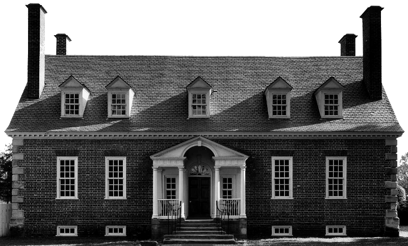
the main house of the Gunston Hall plantation has been restored, but the slave cabins are still missing
Source: Virginia Department of Historic Resources, National Register Nomination: Gunston Hall, Fairfax County
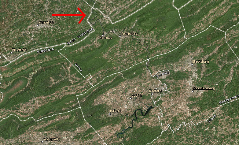
Finally, look at the satellite image of Western Virginia. Can you find the spot in Giles County where the New River flows into West Virginia?
Source: Color Landform Atlas of the United States, Western Virginia
Here is a clue: the New River flows from Claytor Lake towards Bluestone Lake in West Virginia, crossing the state border at Giles County. The river is flowing northwest, "up" the map. If you raft through McCoy Falls near Virginia Tech and just keep on going, you will flow with the waters of the New River into the Kanawha River, the Ohio River, the Mississippi River, and past New Orleans to the Gulf of Mexico.
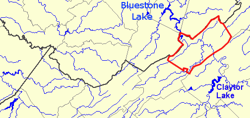
Giles County is outlined in red
Source: US Geological Survey (USGS) - National Atlas
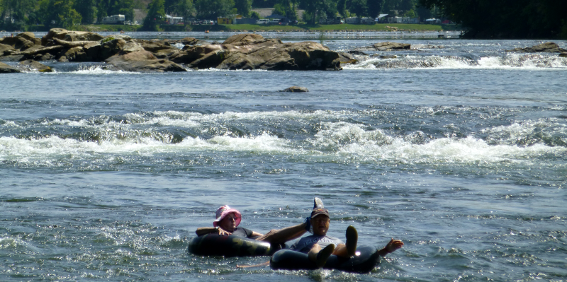
McCoy Falls on the New River (Montgomery County)
To be sure you got it, click on the satellite image of Western Virginia to see where the New River crosses the state border.